Low-Income Share of the Population in the Kansas City Metro Area
Low-Income Share of the Population in the Kansas City Metro Area
This interactive map shows what share of a zip code’s residents are low income for the three counties in the Kansas City metropolitan area that have the largest overall immigrant populations: Johnson County, Kansas; Wyandotte County, Kansas; and Jackson County, Missouri. Hover over a zip code to display the low-income share of its population.
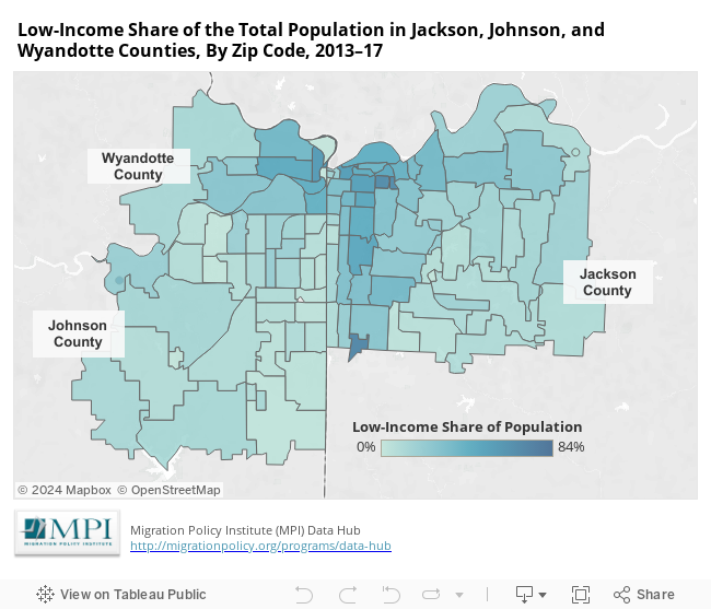
Low-income persons are those who had family incomes below 138 percent of the federal poverty level.
U.S. Census Bureau, 2013–17 ACS 5-Year Estimates, Table S2701, “Selected Characteristics of Health Insurance Coverage in the United States.”
For other maps that show demographics and health insurance coverage in the Kansas City metro area, and for an issue brief that analyzes these characteristics, click here.